


In the vast realm of survival skills, understanding and utilizing the terrain is paramount. Whether you’re an avid hiker, a survivalist, or someone who loves the great outdoors, the ability to read and use the terrain can be the difference between a successful adventure and a perilous situation. This article delves deep into the nuances of terrain reading, offering insights into its importance, techniques, and practical applications. By the end of this piece, readers will have a comprehensive understanding of how to harness the power of the terrain to their advantage, ensuring safer and more informed journeys into the wild. From the undulating curves of valleys to the deceptive calm of plains, every landscape tells a story. Our goal is to help you decipher that story and use it as a guide in your survival endeavors.
Survival Tip: Learn How to Read and Use the Terrain
Table of Contents
- Why is Reading the Terrain Essential?
- Basic Techniques for Reading Terrain
- Practical Applications in Survival Situations
- Terrain and Navigation Tools
- Frequently Asked Questions
- Final Thoughts
- Sources
Why is Reading the Terrain Essential?
Understanding the terrain is not just a skill but a fundamental aspect of survival and outdoor navigation. Its importance is multifaceted, and here’s a deeper dive into why reading the terrain is indispensable:
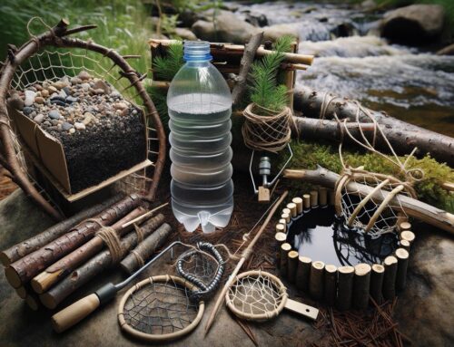
- Predicting Water Sources: Water is the essence of life. In survival situations, finding water can be the difference between life and death. Valleys, depressions, and low-lying areas often indicate the presence of streams, rivers, or underground springs. By reading the terrain, one can predict where water might accumulate or flow, ensuring a consistent supply in dire circumstances.
- Anticipating Potential Dangers: The terrain can often give away signs of impending dangers. For instance, areas with loose soil and steep inclines might be prone to landslides, especially after rains. Similarly, flat terrains with signs of watermarks could be flood zones. Recognizing these signs can help individuals avoid or prepare for these natural calamities.
- Efficient Route Planning: Whether you’re hiking, hunting, or simply exploring, knowing the lay of the land can significantly aid in charting out routes. It can help you avoid impassable obstacles, find shortcuts, or choose the safest path. For instance, a ridge might offer a vantage point to scout the area ahead, while a meadow might provide a suitable campsite.
- Finding Shelter: In survival scenarios, shelter is paramount to protect oneself from harsh weather conditions, wild animals, or other threats. Natural formations like caves, overhangs, or even dense thickets can offer protection from the elements. Understanding the terrain can lead you to these natural sanctuaries faster.
- Hunting and Foraging: The lay of the land can provide clues about the presence of wildlife or edible plants. For instance, animals might frequent water sources, making them prime spots for hunting. Similarly, certain terrains might be more conducive to the growth of edible plants or fungi.
- Understanding Weather Patterns: Terrain plays a significant role in local weather conditions. Mountains can block or redirect prevailing winds, leading to rain shadows or creating microclimates. By understanding how terrain influences weather, one can better prepare for sudden weather changes.
- Enhancing Situational Awareness: In essence, reading the terrain enhances one’s situational awareness. It allows individuals to be more in tune with their surroundings, anticipate challenges, and make informed decisions. This heightened awareness can be crucial in emergency situations, where every decision can have significant consequences.
Reading the terrain is a holistic skill that intertwines with various aspects of outdoor survival and exploration. It’s a blend of observation, experience, and intuition, making it an essential tool in the survivalist’s arsenal.
Basic Techniques for Reading Terrain

Reading the terrain is a blend of science, experience, and intuition. While some techniques are rooted in established methodologies, others come with time and exposure to various landscapes. Here’s an expanded look into the basic techniques for understanding terrain:
- Contour Lines on Maps: One of the primary tools for understanding terrain is a topographic map, which uses contour lines to represent elevation. These lines connect points of equal elevation. When contour lines are close together, it indicates a steep slope. Conversely, lines spaced further apart suggest a flatter terrain. By studying these lines, one can visualize the terrain’s undulations and gradients without even setting foot on it.
- Observation and Ground Truthing: While maps provide a bird’s-eye view, there’s no substitute for on-ground observation. Look for patterns in the landscape—changes in vegetation might indicate water sources, while barren patches could suggest rocky or infertile ground. Ground truthing involves comparing what you see on the map with the actual terrain to ensure accuracy.
- Sun and Shadows: The sun’s position can be a valuable tool for gauging direction and time. In the Northern Hemisphere, the sun rises in the east and sets in the west, moving southward in the sky. Shadows cast by prominent features like mountains or trees can also give clues about the terrain’s orientation and elevation.
- Water Flow: Water always flows downhill, following the path of least resistance. By observing the direction of water flow, whether in streams, rivers, or even after a rain shower, you can infer the gradient and shape of the land.
- Vegetation and Soil: Different terrains support different types of vegetation. For instance, marshy areas will have reeds and water-loving plants, while higher elevations might feature coniferous trees. Similarly, the type of soil, its moisture content, and color can provide hints about the terrain and its features.
- Animal Trails and Signs: Animals, especially larger mammals, often create trails that navigate through the terrain efficiently. These trails can be indicators of safe passages, water sources, or even potential dangers. Additionally, observing animal behavior can give insights into the environment; birds circling can indicate thermal updrafts in mountainous regions, while a sudden scatter of wildlife might suggest a predator—or another danger—nearby.
- Wind and Weather Patterns: Terrain significantly influences local wind and weather patterns. For instance, mountains can act as barriers, creating windward and leeward sides, leading to different microclimates on each side. Observing how clouds form, move, or dissipate can also provide clues about the terrain.
- Use of Tools: Modern technology has given us tools like altimeters, which measure altitude, and clinometers, which measure slope angle. These can be invaluable in understanding and navigating challenging terrains, especially in conditions of poor visibility.
- Local Knowledge: Never underestimate the value of local knowledge. Indigenous communities or locals often have a deep understanding of the terrain, developed over generations. Engaging with them can provide insights that maps or tools might miss.
Mastering these techniques requires practice and patience. Over time, as one becomes more attuned to the environment, reading the terrain becomes an instinct, enhancing safety, awareness, and the overall outdoor experience.
Practical Applications in Survival Situations
In survival situations, every decision can have life-altering consequences. The terrain, often overlooked in everyday scenarios, becomes a critical factor in these circumstances. Here’s a deeper exploration of how understanding the terrain can be applied practically in survival situations:
- Water Procurement: Water is a primary survival need. By understanding terrain features, one can locate potential water sources. For instance:
- Valleys and Depressions: Water naturally flows downhill, collecting in lower areas. Following valleys or depressions can often lead to streams or ponds.
- Morning Dew: Flat terrains or meadows can accumulate dew in the early morning, which can be collected using a cloth.
- Rocky Areas: Depressions in rocks can trap rainwater, providing small but crucial water sources.
- Shelter Building: The right terrain can offer natural shelters or at least favorable conditions to build one.
- Caves and Overhangs: These natural formations, often found in hilly or mountainous terrains, can provide immediate protection from elements.
- Windbreaks: Dense forests or thickets can act as barriers against strong winds, making them ideal spots to set up camp.
- Elevation: In areas prone to flooding, elevated terrains or hills can offer safety from rising water levels.
- Avoiding Natural Hazards: Recognizing and avoiding potential dangers is crucial.
- Avalanche Zones: In snowy terrains, areas with a gradient of 30-45 degrees are most prone to avalanches. Recognizing these and staying clear can be life-saving.
- Flash Flood Areas: Canyons or dried river beds in arid regions can suddenly fill up during rains, leading to flash floods.
- Swampy Ground: Flat terrains with dense vegetation might indicate marshes or swamps, which can be treacherous to navigate due to hidden water pockets or quicksand.
- Navigation and Route Planning: Terrain plays a pivotal role in navigation.
- Ridges and Peaks: These high points offer vantage views, allowing one to scout the area, spot landmarks, or plan routes.
- Rivers and Streams: These can serve as natural navigation aids. Following a stream downhill can often lead to larger water bodies or even human settlements.
- Food Procurement: Terrain can influence the availability of food sources.
- Forest Floors: Rich in vegetation, these areas can offer edible plants, fruits, or even game.
- Water Bodies: Lakes, rivers, or coastal terrains can provide fish, mollusks, or other aquatic food sources.
- Signaling for Help: In situations where one needs to signal for rescue, terrain can be used to enhance visibility.
- Clearings: Open terrains like meadows can be used to create large signals, like SOS, which can be spotted from the air.
- High Points: Lighting a fire or using mirrors on elevated terrains can increase the chances of the signal being seen from a distance.
- Conserving Energy: In survival situations, conserving energy is paramount. By understanding the terrain, one can choose paths that require the least resistance, avoid retracing steps, or bypass obstacles.
- Understanding Microclimates: Different terrains can have varying microclimates. For instance, the temperature at the base of a mountain can be significantly different from its peak. Recognizing these differences can aid in preparation and adaptability.
The terrain is a treasure trove of information and resources in survival situations. By reading and understanding it, one can make informed decisions, optimize resources, and significantly enhance the chances of survival.
Terrain and Navigation Tools

Navigating through diverse terrains requires a combination of innate skills and the right tools. While understanding the terrain is crucial, complementing that knowledge with navigation tools can greatly enhance one’s ability to move safely and efficiently. Here’s a detailed look at some of the essential tools and how they interact with terrain:
- Topographic Maps: These are detailed, two-dimensional representations of three-dimensional terrains. They use contour lines to depict elevation changes, allowing users to visualize hills, valleys, plateaus, and other terrain features.
- Scale: It’s essential to understand the scale of a topographic map. A map with a 1:25,000 scale means that 1 cm on the map represents 25,000 cm (or 250 meters) in reality.
- Legend: Maps come with legends that explain the symbols used, helping identify features like water bodies, forests, roads, and more.
- Compass: This age-old navigation tool points towards the Earth’s magnetic north, aiding in determining directions.
- Magnetic vs. True North: It’s crucial to understand the difference between magnetic north (where the compass points) and true north (geographical north). The difference between the two is called magnetic declination, and it varies by location.
- Sighting Mirror: Some compasses come with a sighting mirror, which helps in getting more accurate bearings by aligning landmarks with the compass needle.
- GPS Devices: These modern tools use satellites to provide real-time location data.
- Waypoints: GPS devices allow users to set waypoints, which are specific locations (like a campsite or water source). This feature helps in route planning and backtracking if necessary.
- Digital Topography: Many advanced GPS units come with built-in topographic maps, offering a dynamic view of the terrain as one moves.
- Altimeter: This tool measures altitude, which is especially useful in mountainous terrains. Knowing one’s altitude can help correlate one’s position on a topographic map, aiding in navigation.
- Barometric Altimeters: These use atmospheric pressure to determine altitude. However, they can be affected by weather changes, so regular calibration is essential.
- GPS-based Altimeters: These derive altitude data from satellites, making them less susceptible to weather-induced errors.
- Clinometer: Also known as an inclinometer, this tool measures the steepness or slope of a terrain. It’s especially useful in mountainous regions to assess the risk of avalanches or to choose the best path up a slope.
- Star Navigation: In the absence of tools, the night sky can serve as a natural compass. The position of certain stars and constellations, like the North Star in the Northern Hemisphere, can help determine direction.
- Landmark Navigation: This age-old technique involves using prominent terrain features like mountains, rivers, or unique rock formations as reference points. By keeping these landmarks in sight or using them to triangulate one’s position, one can navigate even without modern tools.
- Apps and Software: With the advent of smartphones, numerous navigation apps have emerged. These apps often combine GPS, topographic maps, and other features, providing a comprehensive navigation tool right in one’s pocket.
While terrain provides the canvas, navigation tools are the brushes that paint the path. By synergizing knowledge of the terrain with these tools, one can navigate even the most challenging landscapes with confidence and precision.
Frequently Asked Questions
Final Thoughts
The art of reading and using the terrain is more than just a survival skill; it’s a testament to human adaptability and our intrinsic connection to the earth. The most crucial takeaway from this article is the profound impact terrain knowledge can have on one’s safety and success in the wilderness. By understanding the land, we not only enhance our survival chances but also deepen our appreciation for the natural world.
Sources
- Smith, John. Terrain Analysis for Survival.
- National Geographic. Topographic Maps and Their Uses.
- Doe, Jane. Survival in the Wild: A Comprehensive Guide.


Leave A Comment